|
|
|
|
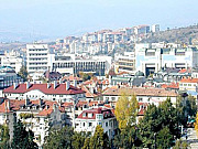 A panoramic view of Blagoevgrad
Blagoevgrad (Bulgarian: Благоевград, formerly: Горна Джумая, Gorna Dzhumaya) is a town in southwestern Bulgaria, the administrative centre of Blagoevgrad Province, with a population of about 75,543(2007). It lies on the banks of the Blagoevgradska Bistritsa River.
The city is the economic and cultural centre of southwestern Bulgaria. It is located in the valley of the Struma River at the foot of the Rila and Pirin Mountains, about 100 km south of Sofia, close to the Greek, Serbian and Republic of Macedonia borders. |
|
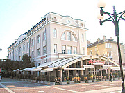 The centre of the town
Blagoevgrad Province (Bulgarian: област Благоевград, oblast Blagoevgrad or Благоевградска област, Blagoevgradska oblast), also known in certain contexts as Pirin Macedonia (Bulgarian: Пиринска Македония, Pirinska Makedoniya), is a province (oblast) of southwestern Bulgaria.
To the north and east it borders with four other Bulgarian provinces, to the south with Greece and the west with the Republic of Macedonia. It has 14 municipalities with 12 towns. The province"s major city is Blagoevgrad, while other significant towns include Bansko, Gotse Delchev, Melnik, Petrich, Razlog, Sandanski and Simitli. |
|
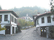 Houses in Varosha, the old quarter of Blagoevgrad
Blagoevgrad features a pedestrian downtown with preserved 19th century architecture and numerous restaurants, cafes, coffee shops, and boutiques. Blagoevgrad is home to two universities, the South-West University "Neofit Rilski" and the American University in Bulgaria. The city hosts also the "Sts.
Cyril and Methodius National Humanitarian High School", the former Bulgarian Men"s High School of Thessaloniki moved from Thessaloniki to Blagoevgrad (then Gorna Dzhumaya) in 1913. Attractions in the surrounding area include the resort Bodrost. |
|
|
An ancient Thracian settlement called Scaptopara emerged on the site around 300 BC and was later conquered by the Roman Empire. The settlement was known for the hot springs in the vicinity.
Although the history of the settlement in the Middle Ages is not known, during the Ottoman rule of the Balkans it was initially a Muslim-majority town called Cuma-l Bala, meaning Upper Juma in Persian and Ottoman Turkish.
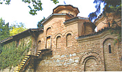
A Bulgarian quarter called Varosha was formed during the Bulgarian National Revival, with many of its typical houses and the Church of the Presentation of the Mother of God from 1844 being preserved to this day. A chitalishte was founded in 1866 and the Balkan Wars of 1912-1913 saw the occupation of the area from Ottoman rule and its integration in the Bulgarian state. Before the Balkan Wars, Cuma-l Bala was bounded as kaza to Serez sandjak in Selanik vilayet. |
|
|
The region is characterized with diversified economic branch structure: food and tobacco processing industries, agriculture, tourism, transport and communications, textile industry, timber and furniture industries, iron processing and machinery industry, construction materials industry, as well as pharmaceuticals, plastics, paper and shoes production. Approximately 10% of the population is unemployed (close to the national average). There are 4 major hospitals in the province.
With its railway line and road connection, the region forms the heart of the land-based trading route between northern Greece, Bulgaria and Romania. Since the early 2000s the province enjoys a mini boom in trade from thousands Greek day-trippers from across the border, purchasing cheaper goods and services (dental, opticians, etc.). Since the early 1990s, the region has also attracted Greek manufacturers who moved their production line from Greece, especially to Petrich. It was an important tourist destination during the communist years for East Germans and is slowly picking up again. The unique town of Melnik was once a wealthy centre built on the back of exiled phanariots from Constantinople. Now it is a centre for wine production and offers eco-tourism. |
|
|
Infrastructure remains relatively underdeveloped, especially regarding road and rail communications. It remains an important target for potential EU funding. There are two major infrastructural projects in the region. The Struma motorway, which is planned to connect the capital Sofia with the Greek border and the port of Thessaloniki, is going to run through the valley of the Sruma River, and will be ready in a few years. The second project is the airport of Bansko. The cost is currently estimated at around ?30,000,000. |
|
|
The province has a territory of 6,449.5 sq.km and a population of 341,245. It is the third largest in Bulgaria after Burgas and Sofia Provinces and comprises 5.8% of the country"s territory. Blagoevgrad Province includes the mountains, or parts of, Rila (highest point of the Balkans — Musala summit, 2925 m), Pirin (highest point — Vihren summit, 2914 m), the Rhodopes, Slavyanka, Belasitsa, Vlahina, Maleshevo, Ograzhden and Stargach. There are two major rivers — Struma River and Mesta River — with population concentrations along their valleys, which are also the main transport corridors. |
|
|
The climate varies from temprerate continental to Mediterranean in the southernmost parts. Natural resources are timber, mineral springs, coal, construction materials, including marble and granite. The beautiful and preserved environment is widely considered an important resource. A number of national parks and protected territories care for the biodiversity. Arable land is 38.8% and forests constitute 52% of the province"s territory. |
|
|
|







 Sofia
Sofia